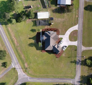
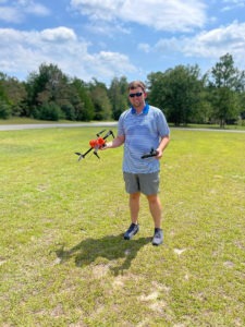
Drone land surveying can be used for many purposes including urban planning, construction, cartography, and property line determination. Drone surveys are particularly useful in areas that are difficult for survey teams to access or when a survey needs to be completed very quickly.
What is a drone topographic survey?
 Wondering what an aerial drone survey is and how it differs from other types of land surveys? Traditional topographical surveys are carried out by a team of land surveyors, whereas a drone survey is performed by an unmanned aerial vehicle (UAV) or drone. The drone is outfitted with sophisticated cameras and can support LiDAR sensors that are able to capture highly detailed data about the land the drone technology captures.
Benefits of drone mapping services
Although surveys completed by drones still require interpretation by a human land surveyor, in certain situations, drone surveying services offer clear advantages over traditional surveying methods as a tool for gathering survey data.
As highly sophisticated machines, drones can collect data with consistent accuracy. Using advanced photographic and LiDAR technology, they can quickly capture a series of high-resolution photos that are easy to read and interpret. Additionally, human surveyors can operate drones from a safe distance, making them a smart choice when the area is treacherous or simply difficult for people to access. Finally, drone surveys alleviate the risk of interference or error that even the most experienced human surveyor can introduce into survey data collection.
More accurate data
A useful land survey must produce reliable data and drone data collection is among the most accurate available. Drones can take hundreds of high-quality photos to capture a wide range of distance and volume measurements very quickly. In other words, drone land surveying will have a high number of useful and accurate data points. The more data points you collect, the more precise your survey data will be.
Also, because a site’s topography can change quickly, the drone survey’s shorter completion window ensures that the survey reflects accurate conditions at a particular moment in time. Lastly, you can use data from drone surveys in a variety of map formats including point clouds, contour lines, digital surface model (DTM) maps, digital terrain models (DTMs) 2D and 3D orthomosaic maps, 3D models, and multispectral maps. Using one device to capture data for so many different types of readings means that an aerial survey using drones can provide the optimal data set for many different purposes.
Survey high-risk/hazardous areas
Have you ever been out on a hike and wished you could soar like a bird above the scenery, taking in every contour of the landscape and every nook and cranny of a rock formation? Sadly, there are certain areas humans simply can’t access without taking extreme – and often highly risky – measures.
Thankfully, land surveying with drones can provide us with a comprehensive picture of an area without putting anyone at risk. As they hover over a geographical area, drones can safely and efficiently capture a depth of data that was previously near-impossible to attain. Using LiDAR, they can also effectively “see through” masses of trees to capture data points from the geographical surface below them.
Minimal crew interference
Even the most experienced land surveyors are not immune to human error. Inaccuracies in survey data can have ripple effects that affect the reliability – and therefore the utility – of your survey. When terrain is particularly difficult for a surveyor to navigate, it may be nearly impossible for them to perform a completely error-free survey. The potential for error is further compounded when survey data is transferred from one person or one computer system to another.
Although a qualified land surveyor will go above and beyond to provide a highly accurate survey, there are some situations in which drone land surveying provides a faster, safer, and more accurate choice. In particular, when an area presents significant hazards for a human surveyor, you are likely to get a quicker and better result from a drone survey. Luckily, the cost will also likely be lower with a drone survey, as less time and labor is needed to complete the survey.
Aerial survey services for faster turnarounds
Whereas most land surveys take between one and three weeks to complete, drone land surveying can collect the required data and create aerial survey maps in as little as one day. Small-scale surveys (spanning fewer than 100 acres) can be completely surveyed by a drone in mere hours. The speed with which a drone land survey can be conducted – as well as the relatively low cost – makes it possible to conduct repeat surveys over time if desired. If you have a project that needs to be surveyed on a regular basis, drone surveys are a great option.
The ease and speed with which a drone survey can be completed lets you move onto the next stage of your project without delay. By offering a speedy yet thorough solution, aerial surveys can help you keep up the momentum as you pursue your goals for your property.
Handle larger projects in a more efficient way
If you are involved in development, construction, or zoning, you may need to survey a large area of land or several individual lots within a short timeframe. In this case, aerial land surveys may be the optimal solution for you.
Using technology that offers unparalleled speed, a high degree of accuracy, and relatively limited labor, drone surveys allow you to maximize efficiency and transition confidently to the next stage of your project. They are also an excellent choice for projects that require ongoing periodic surveying throughout the development process.
A more cost-effective solution
If your project budget is limited – or if it will require repeat surveys over time – drone land surveying can save your company money without sacrificing quality. Contact our expert team to learn more about what our drone survey entails.
Find a professional drone survey company

Our services are a cut above the rest because we always put the latest technologies to work for our clients. By embracing cutting-edge solutions, Scalice takes advantage of the best tools the market has to offer, including drones.
Get a free quote
If you think a drone land survey may be the right solution for you, contact Scalice for a free consultation and quote. Our team members will walk you through the process and answer any questions you may have about the survey. If you decide to go with Scalice, our experienced and insured drone pilots will get you the data you need with speed and precision.
Contact us today at (855) 476-4111 to schedule a drone land survey. We’ll review your goals for the survey and offer details on our matching services during your free initial consultation. You can also contact us by submitting a survey query or quote request via our online contact form.
Drone Surveying FAQs
Which drones do you use?
We only use the most advanced and current drone technology available, specifically designed for drone land surveying. Our drones are equipped with sophisticated cameras and LiDAR sensors to map every piece of land with the utmost precision and continuous accuracy for easy human interpretation.
Why would I need a survey like this one?
Drone land surveys are best employed in instances when the terrain you need to survey is difficult for a human surveyor to navigate or access, when a survey must be turned around quickly or repeated periodically over time, and when a company’s budget will not accommodate a more labor-intensive form of surveying.
How much does it cost?
Your drone mapping services cost, like the cost of all surveys, will depend on the size, location, and terrain of the area you wish to survey. It will also depend on the reason for the survey (e.g., for property boundary assessment, title insurance, development, or construction).
What is LiDAR?
LiDAR stands for Light Detection And Ranging. Many laypeople refer to it as “laser scanning” or “3D scanning”. Our LiDAR services use scanners to emit thousands of laser pulses every second. These pulses bounce off objects and return to the scanner. The time it takes for the pulse to bounce and return is calculated to create a single point.
LiDAR mapping services repeat the process millions of times per second to create a 3D model of the scanned environment with highly accurate measurements.
What are the best use cases for drone LiDAR services?
LiDAR has several use cases. Some of the best use cases for aerial LiDAR services for firms like Scalice include designing new constructions on existing land, spotting irregularities, and creating detailed 3D images of an area. LiDAR services can generate Digital Elevation Models (DEMs) and Digital Terrain Models (DTMs).
How accurate are LiDAR mapping services?
Drone LiDAR services are prioritized for their enhanced accuracy. Using aerial LiDAR services will enable you to achieve an accuracy of 0.002-0.197”, far surpassing traditional land surveying methods.
These highly accurate measurements can be achieved on the first pass, meaning there is far less work required to complete the land surveying process. Taking the human element out of land surveying is pivotal to achieving more accurate surveys.
What’s the difference between 2D and 3D Orthomosaic Maps?
Drone land surveying can be used to create an orthomosaic map. In a process known as photogrammetry, hundreds of overlapping photos of an area are pieced together to create a representation of the land. Each point on the map has an X-Y axis, which allows the viewer to pinpoint locations with great accuracy.
A 2D orthomosaic map created using this method can reveal important data such as the horizontal distance between two points. However, if you are in need of a drone map with a higher level of detail and accuracy, a 3D orthomosaic map is generally a better choice. 2D orthomosaic representations, because they are flat, may introduce distortions in areas where land elevation varies considerably. A 3D map can correct such distortions, creating a more accurate representation of the landscape. 3D maps are often used to help plan construction projects.
Which other deliverables will I get access to?
The data collected by drone surveying and mapping can be used to create a number of deliverables, including:
- 2D and 3D orthomosaic maps, which combine hundreds of high-definition photographs to create a detailed topographic map
- Multispectral maps, which focus on data within a particular electromagnetic wavelength range to help clients in the agriculture sector troubleshoot problems
- Point clouds, which use LiDAR technology to penetrate tree and ground cover to collect data about the terrain beneath them.
